As of 6th September 2021, The CNSA –China National Space AdministrationCLEP- China Lunar Exploration Program Belt and Road Initiative Lunar Mission……Chang’e-4 with Yutu two the Lunar rover still working exploring more than 799 meters on the other side of the moon on the 103 Kilometers Diameter Von Karman Crater in which is least than two length by length fifty five Kilometers Hong Kong –Macau- Zhuhai Bridges …. Working Exploring the Crater on the other side of the Moon Chang’e Luna….
Having exploring more than 799 meters taking lunar photography with the ultimate Lunar Selfies in which gathering then Yutu two Lunar Rover team China Lunar and Deep Space Exploration Engineering Ground Application System also : Lunar and Planetary Data Publishing System… After processing the eighteenth batch of scientific data just released by Chang’e-4, a part of it was selected to synthesize several large pictures to continue to show the desolation of the moon. The first three shots were taken in full color mode, and the fourth shot was a high-definition photo in color mode.
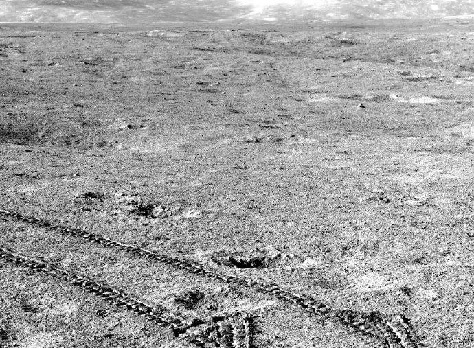
Processing the eighteenth batch of scientific data of Chang’e 4 was released, and the mileage of Yutu 2 reached 799 meters On September 3, 2021, the ground application system of the lunar exploration project publicly released the 18th batch of scientific data of Chang’e 4. As of the end of August 2021, the Chang’e 4 lander and the Yutu 2 lunar rover have completed the 33rd month of scientific exploration, and the lunar rover has accumulated a mileage of 799 meters. The data released this time is provided by the ground application system, including the scientific data obtained by the four scientific payloads on the Chang’e 4 lander and the patrol vehicle (Yutu 2 lunar rover) during the second December day. There are a total of 603 data files, with a total data volume of 2.82GB……
Images and visuals are from CNSA- China National Space Administration also from there respectives…!
On the week of 16th August 2021 Monday Wenchang Spacecraft launch Center –Hainan Province –China – People’s Republic of China.. It was the preparations of CNSA – China National Space Administration– China’s Tianzhou-3 cargo spacecraft to be prepared for this later month or early next month launching of the Long March- Chang Zheng 7Carrier Rocket …长七遥四星星安全运到文昌机场航场 According to the China Manned Space Engineering Office, the Long March 7 Yaosi carrier rocket for the Tianzhou-3 mission has completed all the development work before it leaves the factory. It is in Beijing It will be safely transported to Wenchang Space Launch Site on August 16, 2021. The Long March 7 Yaosi carrier rocket and the Tianzhou-3 cargo spacecraft that have already arrived in advance will carry out the final assembly and testing of the launch site as planned.
In addition, the manned spacecraft and launch vehicle for the Shenzhou 13 mission are simultaneously carrying out various preparations at the Jiuquan satellite launch Center –Inner Mongolia in Preparations as planned. According to reports, after my country’s manned space project enters the space station stage, multi-task cross-parallel will become the norm. At present, the facilities and equipment of the two launch sites are in good condition, and the participating systems are fully preparing for missions.
As of 7th August 2021, The CNSA –China National Space AdministrationCLEP- China Lunar Exploration Program Belt and Road Initiative Lunar Mission……Chang’e-4 with Yutu two the Lunar rover still working exploring more than 708 meters on the other side of the moon on the 103 Kilometers Diameter Von Karman Crater in which is least than two length by length fifty five Kilometers Hong Kong –Macau- Zhuhai Bridges ….
Today The team of the Lunar Exploration Engineering Ground Application System recently announced a new batch of scientific data on Chang’e-4 on the website. Among them, the panoramic camera part of the patrol has a total of about 400 photos, and some of them are selected and put up here.
Most of this batch of photos was taken between July 16th and August 23rd, 2020, and they were taken in full-color mode, so they were black and white photos after processing, but they also magically “included” two Color photo taken on February 7, 2021 (the last two). The photos can be seen from the surface of the moon is really timeless scientifically wild in exploration with wonder, in that wondering hopefully with the Mars rover photographically images data could be fully disclosure….
Also worth mentioning is the original “lunar exploration data publishing and information service system” website is now fully Revised and renamed “Moon and Planetary Data Release System”, with two different data release pages for “Moon” and “Mars”. At present, the Mars data part is in the protection period application status. Looking forward to the data and images from Tianwen-1 Full disclosure…..
Images and visuals are from CNSA- China National Space Administration also from there respectives…!
天问一号飞運騎遊達达3亿 …….As of 11th June 2021Friday CNSA – China National Space Administration – ESA – European Space agency Belt and road initiative mars mission…first Mars exploration mission, Tianwen- Martian Probe One …….”祝融号Zhu Rong” Mars Lander – Mars rover successfully sent back telemetry towards China National Space Administration released a high-resolution image of the landing area of China- People’s Republic of China’s first Mars exploration Tianwen-1 mission. The image of the Zhongtianwen-1 landing platform, the “Zhurong” rover and the surrounding area are clearly visible. Also to of the ultimate Mars Selfie of itself also it’s Mars Landing platform in releasing a high definition patches of travelling least six meters of it landing platform 天问一号-1 landing on Mars first batch of scientific images revealingly…
That Mars on Hong Kong SAR- Beijing Earth Friday time On June 11th 2021 , at the unveiling ceremony of the first batch of scientific image maps of the Tianwen-1 rover landing on Mars in Beijing, the panoramic view of the landing site, the topography of Mars, the “Chinese imprint” and the image taken by the “Zhurong” rover were announced. “Photographs with the tour” and other image maps. The release of the first batch of scientific image maps marked the complete success of my country’s first Mars exploration mission.
The panoramic view of the landing site is a 360-degree ring shot taken by the navigation terrain camera on the rover’s mast before the rover has left the landing platform, after correction and mosaic stitching. The image shows that the terrain near the landing site is flat, the Martian horizon can be seen in the distance, and the abundance and size of the rocks are consistent with expectations, indicating that the autonomous selection of the landing site and the implementation of hovering obstacle avoidance are effective.
The Mars topography map is the first topography and geomorphology image map taken by the navigation terrain camera after the rover reaches the surface of Mars. The image shows that the nearby surface is relatively flat, with stones of different sizes distributed, with smooth edges, lighter colours, and semi-buried. There is an annular pit at the far end, and the edges of the annular pit are distributed with darker, angular stones. , And a few sand dunes farther away. The “Chinese Imprint” map is an image of the landing platform taken when the Mars rover travels to about 6 meters southeast of the landing platform 60° southeast. The image shows that the landing platform is shining, the national flag is bright red and square, and the surface is rich in details.
The picture of the “touring group photo” shows the rover traveling about 10 meters south of the landing platform, releasing the separate camera installed at the bottom of the vehicle, and then retreating to the vicinity of the landing platform. The separate camera took pictures of the movement of the rover and the photo of the rover and the landing platform. The image is transmitted to the rover through wireless signals, and then relayed back to the ground by the rover through the orbiter
images of the mascots of the 2022 Winter Olympics “Bingdundun” and “Xuerongrong” on the landing platform
Mars surface Photography of Zhurong with the landing platform …. The picture of the “tourist group photo” shows the rover traveling about 10 meters south of the landing platform, releasing the separate camera installed at the bottom of the vehicle, and then retreating to the vicinity of the landing platform. The separate camera took pictures of the movement of the rover and the photo of the rover and the landing platform. The image is transmitted to the rover through wireless signals, and then relayed back to the ground by the rover through the orbiter.
Chinese Imprint” image, the image of the landing platform taken by the Zhurong Mars rover driving to about 6 meters southeast of the landing platform 60° south. The image shows that the landing platform is shining, the national flag is bright red and square, and the surface is rich in details.
Images and visuals are from Weibo of CNSA – China National Space Administration – CLEP –China Lunar Exploration Program
天问一号飞運騎遊達达3亿 …….As of 15th May 2021 CNSA – China National Space Administration – ESA – European Space agency Belt and road initiative mars mission…first Mars exploration mission, Tianwen- Martian Probe One …….”祝融号Zhu Rong” Mars Lander – Mars rover successfully sent back telemetry signals and landed on Mars with a complete success
At 7:18 Hong Kong SAR – Beijing Time on May 15th 2021 , the scientific research team confirmed according to the telemetry signal sent by the “Zhurong” Mars rover that the Tianwen 1 Landing Patrol successfully landed in the pre-selected landing zone in the southern Utopia Plain of Mars, and my country’s first Mars exploration mission landing on Mars was achieved. A complete success.
At about 1 am, the Tianwen-1 probe was de-orbited in its parked orbit, maneuvering to Mars and entering orbit. At about 4 o’clock, the landing patrol was separated from the orbiter. After about 3 hours of flight, it entered the Martian atmosphere. After about 9 minutes of deceleration, hovering, obstacle avoidance and buffering, it successfully landed on the pre-selected landing zone. About 30 minutes after the two devices are separated; the orbiter will ascend and return to the parking orbit to provide relay communication for the landing patrol device. In the follow-up, the “Zhurong” rover will successively carry out global imaging of the landing site, self-check, leave the landing platform and carry out inspections.
Hello, everyone, I am the “Zhu Rong” rover. Since I landed on Mars on the 15th, my friends on Earth have moved their benches and have been looking forward to seeing the pictures. I also asked anxiously, what am I up to?
No, today I have provided 2 pictures taken after landing, and a video of the separation of the two devices (the surround device and the landing patrol device) was added for a good value, so that everyone can feast their eyes on it.
Why have you waited so long?
As we all know, the farthest distance between Mars and the Earth is about 400 million kilometers, and radio waves travel at the speed of light, and the attenuation of signal energy is proportional to the square of the propagation distance.
I have configured two communication methods, one is to communicate directly with the earth, and the other is to communicate with the earth through the Tianwen-1 orbiter relay. Why do we need relay to communicate directly? That’s because I am about 320 million kilometers away from the earth, which is too far away. Even if I keep shouting with my throat, the earth can only receive very little data, which is too slow and can only send back the most important information. As soon as I landed on the 15th, I directly reported “I have landed and feel good” to my family, and my friends started cheering for me!
After landing, I took some photos with the camera I carried, and I can’t wait to share them with you. However, if it is sent directly back to the earth, even if it is a photo like Figure 1, it would theoretically take more than eight hours. And because of the rotation of Mars, I can communicate directly with the earth for less than half an hour every day, so I abandoned the function of directly transmitting images to the earth. Therefore, I have to wait for the repeater of the surround device. He is big and has a loud voice, and transmits data to the earth much faster than me.
On the 17th, the orbiter entered the relay orbit, and we first established a communication link. Because he orbits Mars for 8.2 hours, we are often blocked by the big guy Mars, so I have to pay close attention to the precious time of relaying, first send back some important data of my own state, and then send it back Image…..
Currently, I am preparing to leave the landing platform. In the follow-up, I will work closely with the orbiter, not only to take pictures of the Martian landscape, but also to use the six scientific payloads I carry to conduct in-depth exploration of Mars and send more scientific data back to the scientists for research. It’s more important than taking pictures……. !!!!!