#CNSA #ChinaNationalSpaceAdministration #国家航天局 |#BeltAndRoadinitiative #酒泉衛星發射中心 #JiuquanSatelliteLaunchCenter  #February2022| Successfully launching of the international Iconic advance improved #ChangZheng4C  #LongMarch4C  #CarrierRocket of the #LandExploration1 #LSAR01B #EnivormentalSatellite #EarthSciences #Satellite the largest SAR Group B satellite.. 

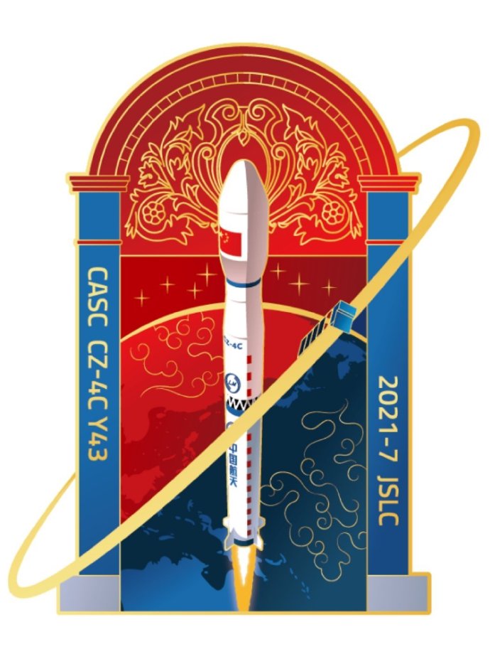
酒泉衛星發射中心On 27th February 2022 Sunday 0744 Hong Kong SAR – Beijing Time  , CNSA –China National Space Administration  Jiuquan Satellite Launch Center – Inner Mongolia – China – People’s Republic of China successfully Launched the International Iconic Chang Zheng 4C – Long March 4C successfully deploying the Land Exploration Satellite

For the launch at the The Year of the Tiger starts…. Chang Zheng –Long March 4C successfully launched the Land Exploration-1 01 group B satellite During At 7:44 morning Hong Kong SAR –Beijing time  the Long March 4C carrier rocket ignited and took off, sending the Land Exploration-1 01 group B satellite into space, and the satellite then entered the predetermined orbit , the task was a complete success.

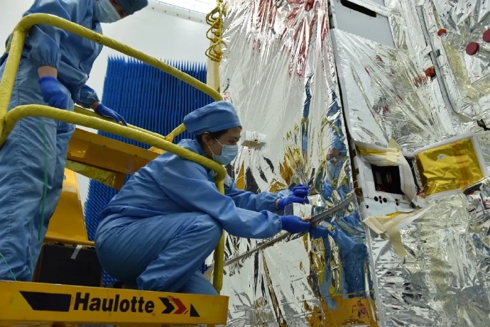
 The 01 group B star of Land Exploration No. 1 was developed by the Eighth Academy of China Aerospace Science and Technology Corporation. After the two stars meet, they will form a close-range flying formation or network operation state with the A star. Double star is mainly based on the differential interference surface deformation measurement task. It has the characteristics of all-weather, all-day, multi-mode and multi-polarization. It can be used in the fields of geology, land, earthquake, disaster reduction, surveying and mapping, and forestry. It can effectively improve my country’s geological disasters. Independent satellite detection

The Land Exploration-1 satellite was approved by the National Space Administration. It is the first satellite model launched during the “13th Five-Year Plan” period of the “National Civil Space Infrastructure Medium and Long-term Development Plan”. It consists of two identical L-band synthetic apertures A and B. It is composed of radar (SAR) satellites. After in orbit, it will achieve repeated orbit differential interferometric deformation measurement and interferometric topographic mapping in follow-flight and orbital modes respectively. As the first satellite of the 01 group of Land Exploration 1, the A star of the 01 group of Land Exploration 1 will work in the follow-flying formation mode with the subsequently launched B star for a long time, and jointly build the world’s first L-plane for surface deformation interferometry applications.  Band double star constellation. In addition to the long-term flying formation configuration, the double star will also conduct collaborative observation in close-range flying formations to achieve large-scale topographic surveys and improve the ability to obtain under-forest topography. Important support for high-precision terrain data update.

The weight of the 01-group B satellite of Land Exploration-1 is about 3.2 tons, and the total area of ​​the SAR antenna exceeds 33 square meters. It is currently the largest SAR satellite in orbit in China. The satellite operates in a quasi-sun-synchronous orbit at an altitude of 607 kilometers, and is equipped with an advanced L-band multi-polarization and multi-channel SAR payload. It has all-day, all-weather, and multi-mode Earth observation capabilities.


The launch of the 01 group A satellite of Land Exploration No. 1 will realize the independent and controllable differential interferometric SAR data in my country, significantly reduce the dependence on foreign SAR data for geological, seismic, emergency and other industrial applications, and contribute to the realization of global goals such as sustainable development. Provide strong technical support for space observation

The satellite of Land Exploration-1 will operate in a network with the subsequently launched Chang Zheng-Long March 4C satellite, which can be used in the fields of geology, land, earthquake, disaster mitigation, surveying and mapping, and forestry, providing support for my country’s autonomous satellite detection and prevention of geological disasters. Maintain national resources and ecological security. According to Wei Chun, deputy chief designer and executive chief engineer of the 01 group of Land Exploration No. 1, the double satellite has filled the gap of China’s L-band land exploration satellite. The L-band signal has the characteristics of long wavelength and good penetration. During observation, the L-band signal can pass through a 20-meter-high tree, and accurately measure the height of the ground, instead of only measuring the height of the forest……

Images and visuals are from their respectives.

#CNSA #ChinaNationalSpaceAdministration #国家航天局 | #BeltAndRoadinitiative #September2021|#太原卫星发射中心 #TaiyuanSatelliteLaunchCenter – Launching of the International Iconic #LongMarch4C #ChangZheng4C #CarrierRocket deploying the #Gaofen5 #EarthSciences #RemoteSensing #Satellites …

At 1101Hours Morning Hong Kong Beijing Time  on a very clear 7th September 2021 Tuesday 2021, China- People’s Republic of China- CNSA –China National Space Administration   Successfully launched  the Long March-Chang Zheng 4C carrier rocket at the Taiyuan Satellite Launch Center Shanxi Province   China successfully launched Long March – Chang Zheng 4C carrier rocket at the Taiyuan Satellite Launch Center to successfully launched the Gaofen-5 02 satellites into orbit…. Making this launch into this mission is the 387th flight of the International Iconic Chang Zheng- Long March series of carrier rockets…..

The Advancements in Chang Zheng Long March 4C Carrier Rocket  in which there’s been many advancements and improvements  is the first to install relay equipment, greatly extending the telemetry time] In this mission, the rocket has optimized the launch trajectory in accordance with the safety requirements of the landing zone, and each sub-system adopts the latest state that has been verified by the flight; the Chang Si C rocket It is the first time to carry a relay user terminal system on the third sub-level. The relay satellite is used to complete the rocket’s active segment information transmission, so as to realize the reception of the rocket’s full range of telemetry signals. Compared with the previous telemetry data transmission method, the relay user terminal system is not affected by ground telemetry. The geographical location of the receiving station can greatly extend the signal transmission time of the rocket. Therefore, the rocket has the advantages of not being restricted by the ground telemetry receiving station and flexible design of the launch orbit; the satellite fairing adopts enhanced rainproof measures to cope with the rainy season conditions in Taiyuan, to ensure that the rocket is launched accurately within the scheduled window….

For the Taiyuan Satellite Launch Center, September 7 is an auspicious day…..On September 7, 1988, the Long March 4 carrier rocket made its first flight here, launching the experimental weather satellite “Fengyun 1″ (also the first meteorological satellite). The People’s Daily announced the next day that the launch site was marked as ” The name “Taiyuan Satellite Launch Center” was opened…… Also On September 7 last year, the Long March 4B carrier rocket successfully launched the Gaofen 11 02 satellite.

The two Gaofen 5 series Remote Earth Sciences Sensing Satellite also the Chang Zheng –Long March 4B were all developed by the Eighth Academy of China Aerospace Science and Technology Corporation. This launch is the 79th launch of the Long March 4B series carrier rocket and the 10th launch this year. It is the 142nd launch of the Long March series of carrier rockets developed by the Eighth Academy of Sciences and the 387th launch of the Long March series of carrier rockets.


The hyperspectral observation satellite launched this time can be used for inland water bodies, land surface ecological environment, altered minerals, crops, forest vegetation and other ground objects, as well as air pollution gases, greenhouse gases, PM2.5 and other environmental and meteorological targets. The global, long-term, quantitative and comprehensive observation of the elements effectively enhances my country’s comprehensive hyperspectral observation capabilities and increases the localization rate of hyperspectral observation data to more than 70%. 

According to the plan, in less than 4 months, the Chang 4 series rockets will perform several launch missions. Zhang Baizheng, the chief designer of the overall structure of the Long Four C rocket, revealed that the number of launches of the Long Four series of rockets will still maintain this frequency next year. 

[ Gaofen GF-5 02 full-spectrum spectral imager developed by 508] As one of the main payloads, the full-spectrum spectral imager is a visible-infrared integrated push-broom imaging space remote sensing camera developed by 508. The imager integrates three imaging channels of visible, short and medium wave, and long wave, which can simultaneously obtain remote sensing images in 12 spectrum bands of visible, near-infrared, short wave, medium wave, long wave, and very long wave. The long-wave infrared detector is a key component of the long-wave imaging channel. It is responsible for converting the received optical signal into an electrical signal, and generating the image we see through the signal processing circuit, the satellite data transmission system and the ground system data processing. The photosensitive surface size of the long-wave infrared detector is only 60mm*12mm. It is hard to imagine that there are nearly 20,000 tiny pixels in such a small chip. Through the optimization and improvement of the preparation process of the very long wave detector chip, the sensitivity of the long wave infrared detector has been increased by 3 times, the gray level of the image has been increased by 3.5 times, and the image quality has been significantly improved compared with the predecessors on the Gaofen-5 satellite .

As a typical representative of China’s visible-infrared common optical path push-broom imaging space optical remote sensor, the full-spectrum spectral imager is the load with the widest spectral range among high-resolution multi-spectral remote sensing cameras in China. In addition to the above advantages, it also has Many “artifacts”: it has 3 imaging channels and 12 spectrum bands, which can be imaged day and night; its long-wave infrared spectrum has the highest spatial resolution of 40 meters for international civil satellites; it passes high-sensitivity detectors and high-precision focal planes Temperature control, high-precision radiation calibration and other methods provide support data for quantitative applications of users, and can accurately and quantitatively obtain surface temperature, water surface temperature, temperature difference range, thermal pollution discharge outlet distribution, mineral information distribution, and vegetation coverage from the image. More detailed information such as the degree of drought and the degree of drought.

The Gaofen5 series Remote Sensing Earth Sciences Satellite manufacturer is CAST – China Academy of Space Technology also in collaboration with its associate agency with CHEOS- China High Resolution Earth Observation System in which is design Built on a CAST 2000 Design Heritage Earth Sciences, in which is design for Translating Gaofen is High Resolution, also known as CHEOS- China High Resolution Earth Observation System, in which provisions in the real time observational data analysis of with high resolution multi spectra equipment imaging system in analysis for assessing environmental disaster warning, emergency response also for the protection for ecological, also providing support for infrastructure construction, transportation for various purpose of the Belt And Road initiative  … one of many specifications of the Gaofen 10 Earth Sciences satellite is The high-resolution satellite is a large-scale remote sensing satellite system for the national science and technology major special arrangement of the microwave remote sensing satellite, the ground pixel resolution is up to sub-meter …

Images and visuals are from Weibo also their respectives..

#CNSA #ChinaNationalSpaceAdministration #国家航天局 |#BeltAndRoadinitiative #July2021|#酒泉衛星發射中心 #JiuquanSatelliteLaunchCenter Launch of the International Iconic #LongMarch4C #ChangZheng4C #长征四 #CarrierRocket deploying an advance #WeatherSatellite #EarthSciences #Fengyun3E …

On 5th July 2021 Monday 0728  a summery clear morning Hong Kong SAR- Beijing Time-  CNSA –China National Space Administration  on which from Jiuquan Satellite launch Center – Inner Mongolia- China-People’s Republic of China… It  successfully launched the international ionic Long March 4C- Chang Zheng 4C Carrier Rocket  in which July 2021 there’s been numerous launches in which celebrating the 100th CPC year anniversary more in China – People’s Republic of China..

Launching scheduling in which this mission is the 377th flight of the Long March series of carrier rockets….deploying on the sending the Fengyun-3 E star into its intended orbit , The launch was a complete success…. The Long March 4 series is developed by the Eighth Academy of Sciences…

The Fengyun-3 E weather earth Science successfully launched deployed..! in which the it’s provision design is as a  Service emergency weather event decision-making evaluation . The Fengyun-3 E satellite is mainly used for weather forecasting, climate forecasting, environmental monitoring and disaster prevention and mitigation, etc. It provides weather detection information for the world, and provides reliable weather data for government departments at all levels to make decisions and assessments of sudden weather events. Fengyun-3 E satellite. E FY FY-III satellite is a satellite of the family’s first dawn orbit meteorological satellite, but also the world’s first implementation of business operations at dawn sun-synchronous orbit meteorological satellite 

Developed by the Eighth Academy of China Aerospace Science and Technology Corporation (Shanghai Institute of Aerospace Technology) has a total weight of 2.69 tons and runs on the earth’s twilight boundary. On the sun-synchronous orbit above, it can fill the gap of satellite observation data in the 6-hour assimilation window of global numerical weather prediction, achieve 100% coverage of global observation data, significantly improve the accuracy of numerical weather prediction, and effectively improve China’s weather forecast prediction, response to climate change, Build disaster prevention and mitigation systems, establish environmental and ecological monitoring, and space weather forecast and early warning capabilities.


The Fengyun-3 E star is loaded with 11 payloads, including 3 newly developed instruments represented by wind field measurement radar, solar irradiance spectrometer and solar X-EUV imager, 7 upgraded instruments and 1 inherited Upgrade the instrument. Among the three newly added payloads, the wind field measurement radar is the first active detection radar carried by the Fengyun series satellites. It is a dual-frequency, dual-polarization cone-scanning microwave radar. It mainly obtains global ocean surface wind field information through sea surface backscatter measurement. ; The solar irradiance spectrometer measures the solar spectral irradiance daily through the three channels of ultraviolet, visible and infrared, and obtains the characteristics of solar spectral irradiance. The measurement data will be widely used in solar physics, atmospheric physics and climate physics. Scientific research; the solar X-EUV imager uses solar radiation in the X-ray band and extreme ultraviolet band radiation to achieve long-term, continuous, high-time-resolved full-plane and low-corona imaging observations of the sun, and obtain high-resolution images of the sun. Space weather forecast provides a more accurate reference.


Among the 7 upgraded instruments, the medium-resolution spectral imager (low-light type) has a new low-light channel, which can obtain images covering the world’s 100-meter level (250m*2600km) spatial resolution, which is 33% higher than the previous generation product. %, is China’s most advanced quantitative global low-light detection instrument; infrared hyperspectral atmospheric sounder (type Ⅱ) medium-wave and short-wave sensitivity will be more than doubled than before; microwave thermometer (type Ⅲ) added 4 channels , The number of detection channels has reached 17; the GNSS-R sea surface wind field detection function has been added to the global navigation satellite occultation sounder (Type II), which will realize the three-dimensional monitoring of the ionosphere, atmosphere and sea surface wind field. For the first time, the integrated detection of GNSS occultation and GNSS-R remote sensing has been realized; the solar radiation monitor (international comparison type) used to monitor changes in solar irradiance and capture solar activity signals is newly added to the Swiss DARA radiometer, which will be realized for the first time in Chinese and foreign instruments Simultaneous observation in orbit. 

Images and visuals are from Weibo..  

#CNSA #ChinaNationalSpaceAdministration #国家航天局 #BeltAndRoadinitiative #March2021| the iconic reliable #LongMarch4C ChangZheng4C #CarrierRocket successfully launching a #遥感式卫星; #Yaogan31 constellation #Satellite for #EarthSciences….


On 13th March 2021 late morning 1019  hour Beijing time morning, launching from the one of many launch complexes centers of the CNSA –China National Space Administration in  Jiuquan Satellite Launch Center in North west Gobi Desert – Inner Mongolia  – China – People’s Republic of China… in which launching the reliable iconic Long March 4C- Chang Zheng 4C  Carrier Rocket satellites into the predetermined orbit …..

Launching from the Jiuquan Satellite Launch Center, is deploying a series of constellation satellites for remote sensing for Earth Sciences, in which are developed also manufactured by the SAST- Shanghai Academy of Space Flight Technology in collaboration with the CAST- China Academy of Space Technology …..

 The provisionments of the 遥感式; Yaogan satellites in which are design as remote sensing  earth sciences satellites in which have multiple installation equipment onboard, with scientific experiments, land surveying, agriculture , disaster monitoring ..  Also with electromagnetic environment detection… in which the Yaogan 31 satellites is place in at an attitude of in between 634-664 Kilometers above earth… at an inclination of ninety eight degrees…   Satellites are mainly used to carry out electromagnetic environment detection and related technical tests. This mission is the 363rd flight of the Long March series of carrier rockets…..

Images and visuals are from Weibo